064
FXUS65 KTWC 251929
AFDTWC
Area Forecast Discussion
National Weather Service Tucson AZ
1229 PM MST Mon May 25 2026
.SYNOPSIS...
There will be a chance of weak showers and thunderstorms
through this afternoon and early evening, mainly northeast of
Tucson towards the White Mountains. Dry conditions return by
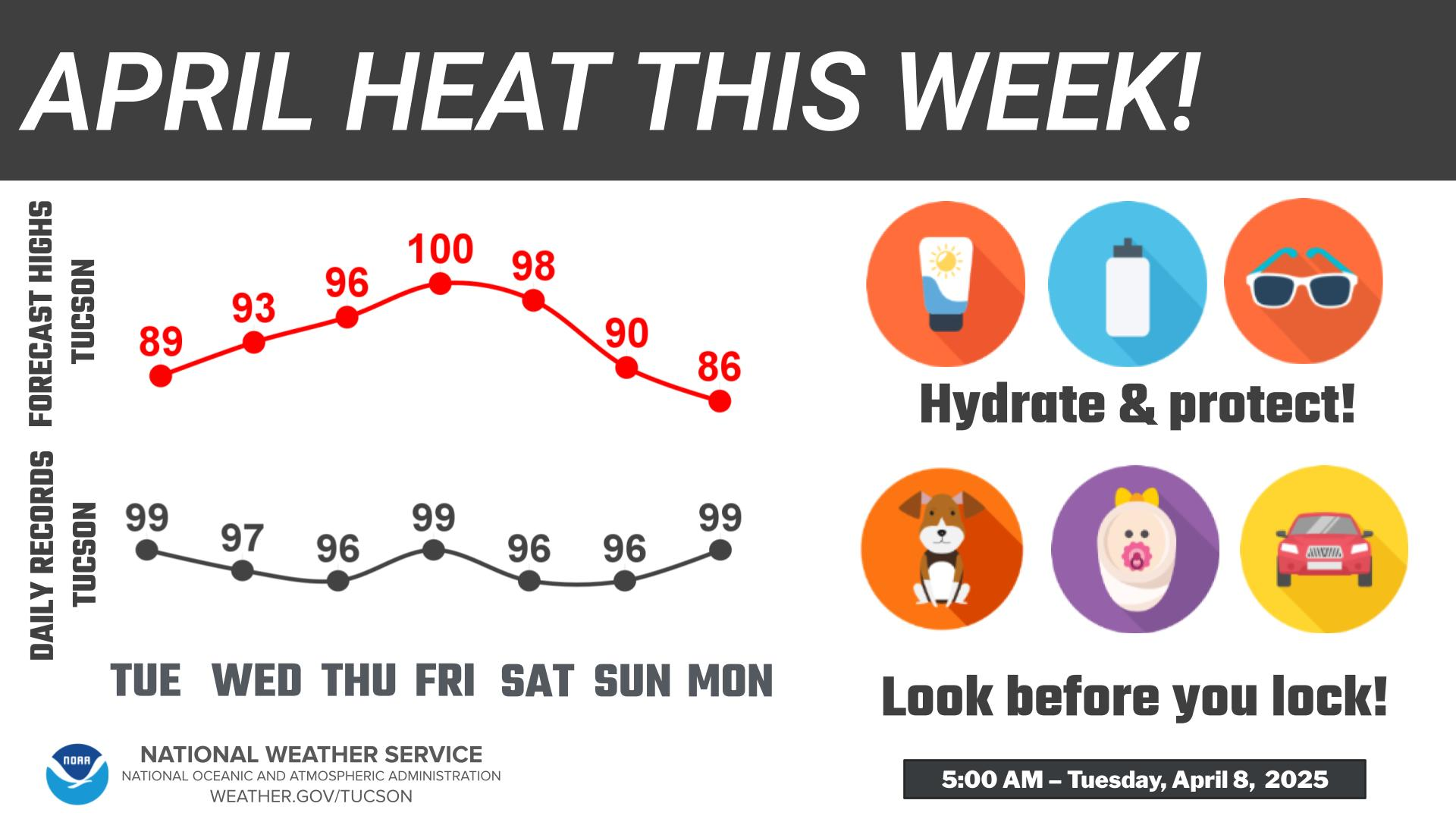
tomorrow into next weekend. High temperatures will remain within
a couple of degrees of normal. Expect breezes today and Tuesday,
with breezy to locally windy conditions across much of
Southeast Arizona Wednesday and Thursday.
&&
.DISCUSSION...
The low pressure system that brought in the mid level moisture
is currently centered in central Arizona, keeping Southeastern
Arizona under west/southwest flow. This flow aloft is slowly
bringing in drier air from the south. Current PWs between 0.3 to
0.5 inches (drier air) in Pima and Santa Cruz counties
(including Tucson) and 0.5 to 0.75 inches areas northeast of
Tucson. The areas with higher moisture have already seen some
shower and thunderstorms in portions of southeastern Pinal
county with an estimated 0.1 to 0.30 inches of rainfall. This
system will slowly continue to move eastward bring drier air
into the region and decrease storm chances into this evening.
As this system moves eastward, behind a Pacific low pressure
system begins to drop southward into California/Nevada mid this
week. This system will not bring any precipitation to
Southeastern Arizona, but will bring breezy to locally windy
conditions Wednesday and Thursday. The combination of elevated
winds and dry conditions can bring near critical fire weather
conditions. This system will keep temperatures right around
normal through the work week.
Once this system passes, models are still showing a building
ridge this weekend, with varying strength and location. This
will bring warmer temperatures, and possibly incoming moisture.
&&
.AVIATION...Valid through 27/00Z.
FEW-SCT 9k-11k ft ceilings mainly north and east of a KTUS-KDUG
line. Isolated shower/thunderstorm activity N/E of KTUS from
25/19Z- 26/02Z, though mainly from near KSAD and north and east.
Gusty and erratic winds up to 40 kts possible with any
thunderstorm. Otherwise surface winds become southwesterly
through the afternoon increasing to 10-14 kts with gusts to 25
kts, becoming light and terrain driven after 26/03Z. Aviation
discussion not updated for TAF amendments.
&&
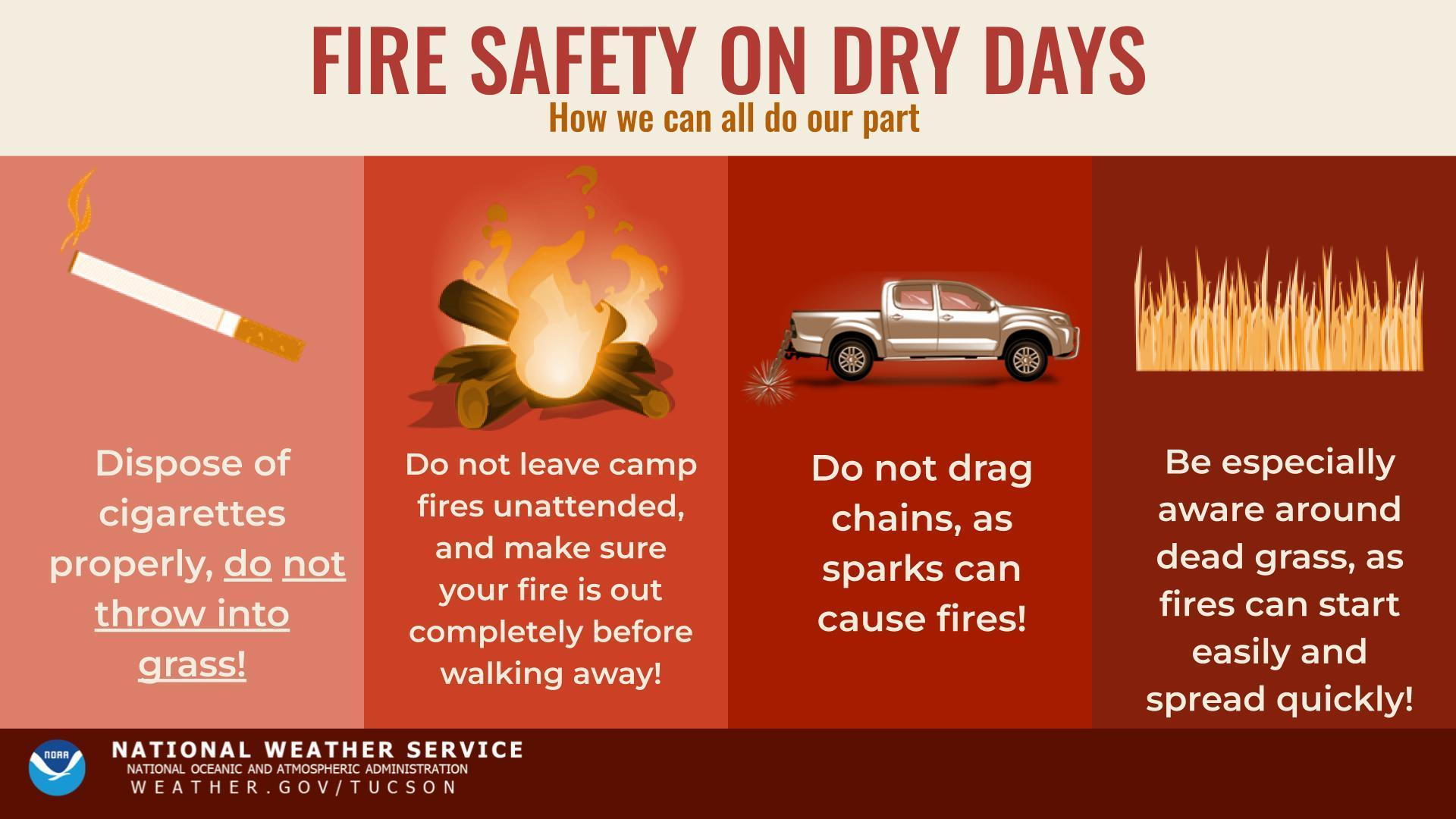
.FIRE WEATHER...
A weak weather system will bring chances for thunderstorms and
rain showers today, mainly northeast of Tucson, towards the
White Mountains. Most of this activity will be a light shower
to virga, although there will be a 10 percent chance for
isolated `dry` thunderstorms and the threat of gusty outflow
winds and lightning. Rainfall amounts will be light, generally
only trace amounts to less than a tenth, with the highest
precipitation totals forecasted in the White Mountains at
0.10"-0.35".
High temperatures will be within a couple of degrees of normal
through this week. Min RH values will be in the 7-18 percent
range in the valleys and in the 14-20 percent range in the
mountains through next week, except on today in the eastern
mountains when RH values will be in the 20-40 percent range.
Breezy southwesterly winds are expected this afternoon and
Tuesday with speeds 15 to 18 mph with gusts up 25 mph. Stronger
southwest winds are expected on Wednesday and Thursday, bringing
elevated fire weather conditions from Sells east.
&&
.TWC WATCHES/WARNINGS/ADVISORIES...
None.
&&
$$
DISCUSSION...JT
AVIATION... Edwards
FIRE WEATHER...JT
Visit us on Facebook, X, YouTube, and at weather.gov/Tucson
NWS Tucson (TWC) Office